Rocky Fork Road Corridor Study
Concept Drawings - Vision for Rocky Fork Road
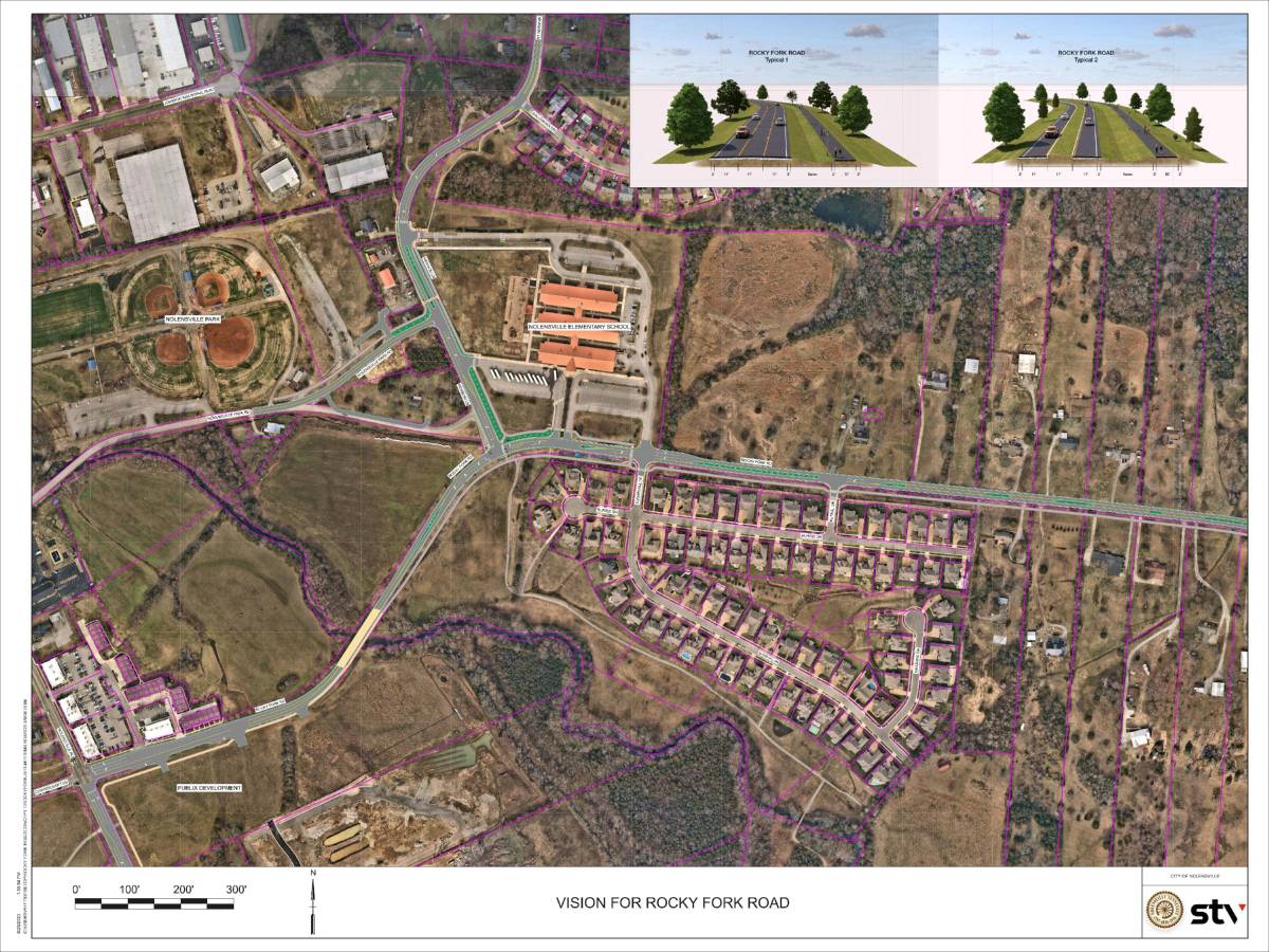
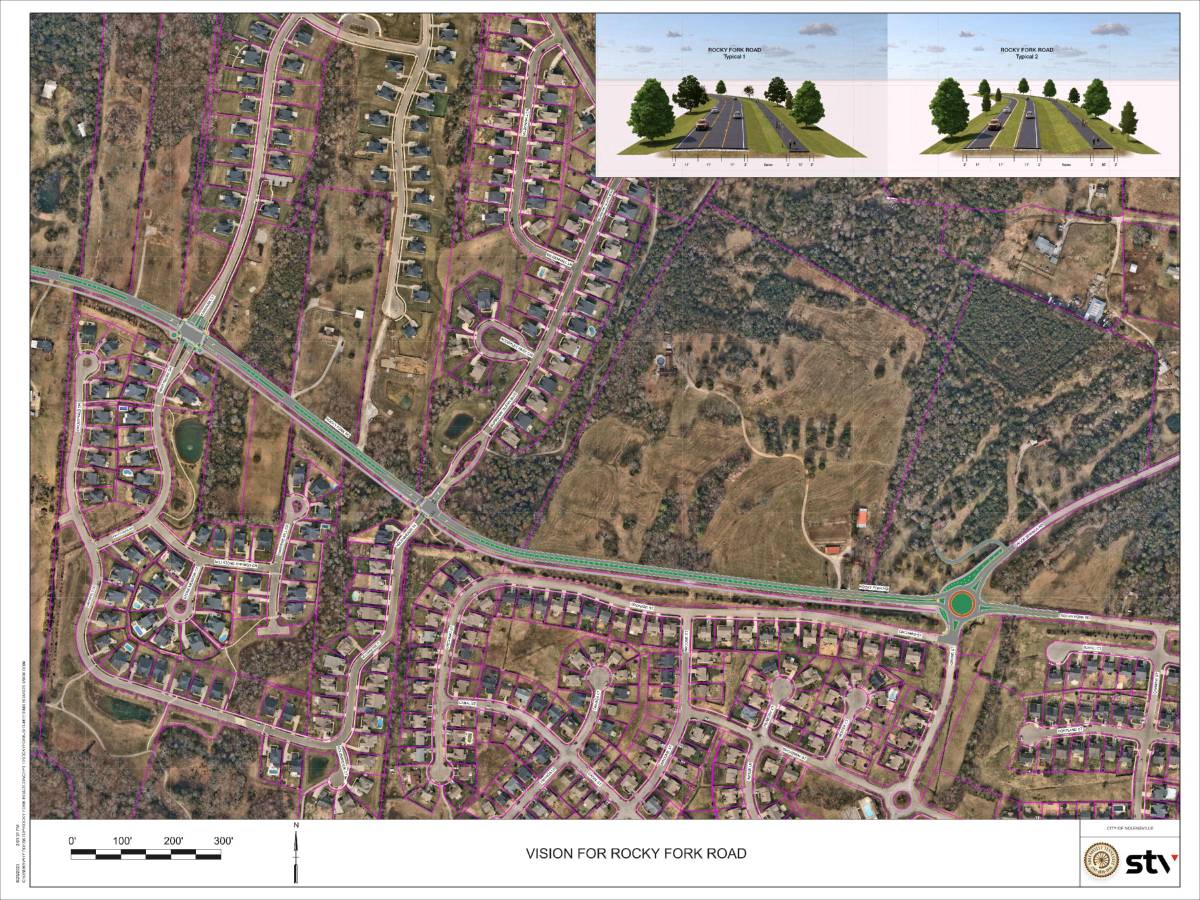
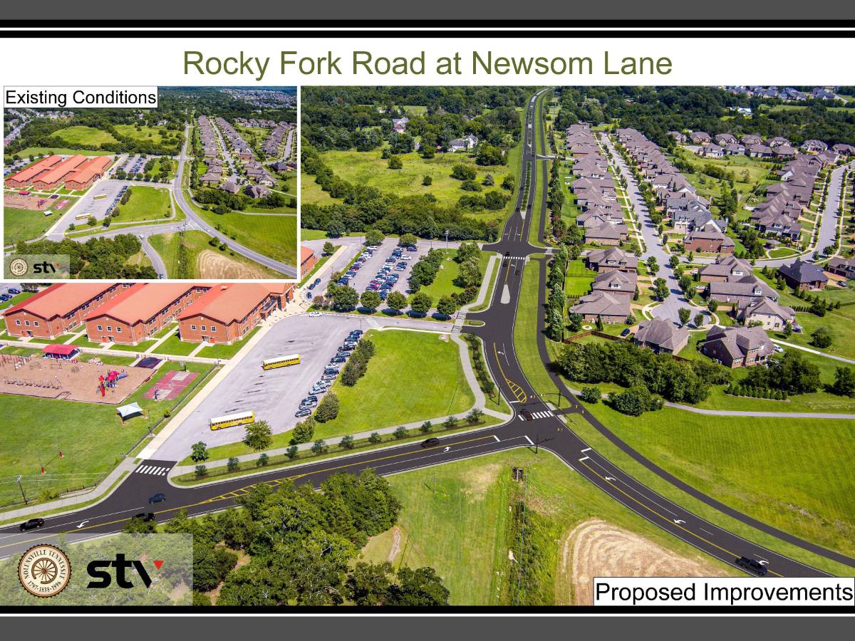
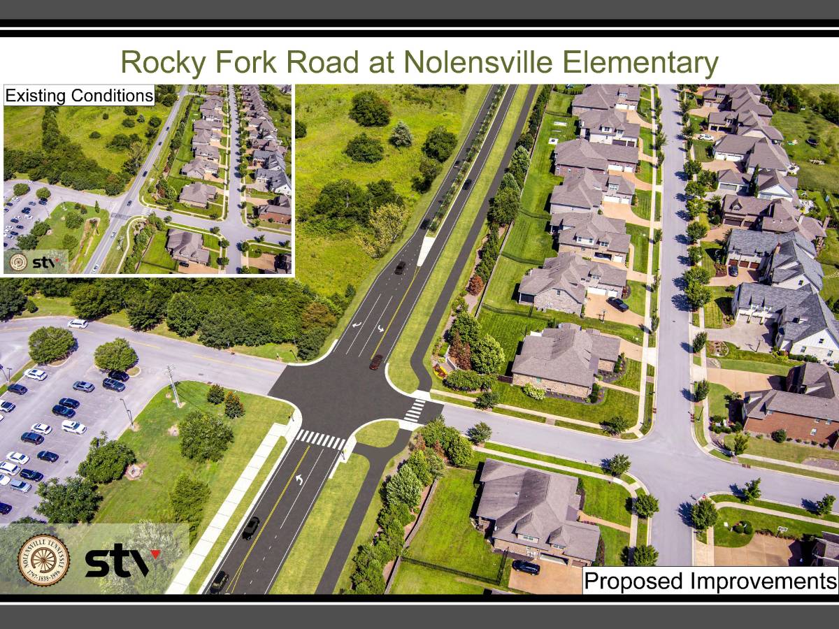
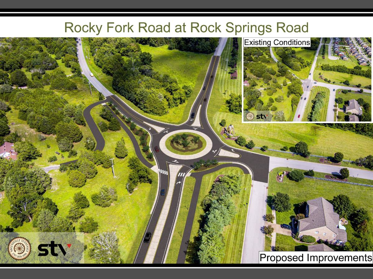
Downloadable PDF's of the renderings can be found here.
In an effort to further improve its transportation infrastructure and to respond to and prepare for planned growth, the Town of Nolensville is preparing a corridor study and associated design to improve the functionality of Rocky Fork Road for motorists, bicyclists, and pedestrians. The study includes the development of conceptual design options for Rocky Fork Road from Nolensville Road (US 31A/US 41A) to Rock Springs Road (approximately 1.7 miles). The study will consider alternatives for intersection types, number of travel lanes, and multi-modal connectivity. The result will be a recommended design concept that will progress into engineering and eventually construction. The intent of the project is to create a new “complete street” that blends in with the fabric of the community while meeting the current and future (2045) mobility and safety needs for Nolensville.
To view the corridor study map, please follow the link: Rocky Fork Road Corridor Study Map
For more information regarding the project, please follow the link: Rocky Fork Road Widening Project
Want to hear the responses from our citizens to identify opportunities to improve the flow of traffic for motorists, pedestrians, and bicyclists on Rocky Fork Road from Nolensville Road to Rock Springs Road? The data and feedback derived from this survey will help guide the project and shape the look and feel of the roadway once it is improved. Through this effort we hope to produce a more efficient transportation corridor that best serves everyone in the Nolensville area.
View our survey responses by clicking here!